Clayton State Day at the Capitol Maps & Directions
Main Campus
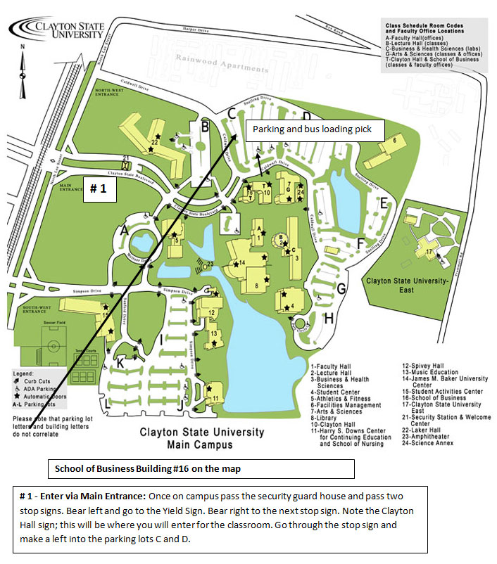
Clayton State University is easily reached by taking I-75 to exit 233 (15 miles south of downtown Atlanta). Turn left and follow the green and white signs for 1 1/2 miles north on Georgia Highway 54. Turn right into Clayton State Boulevard.
From I-675 take exit 5 west and continue straight on Forest Parkway for two miles. Turn left onto North Parkway. At the first traffic light, Harper Drive, North Parkway becomes North Lee Street. Continue straight on North Lee Street for one block to the next traffic light. Turn left onto Clayton State Boulevard. Get the printable version of the campus map below.